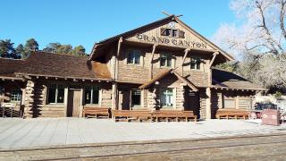
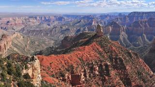

Two days on the South Rim are enough to see the canyon from three angles: from the edge at its busiest viewpoints, from the quieter western rim along Hermit Road, and from a few hundred metres below the rim on the Bright Angel Trail. Day one stays on foot and on the free shuttle around Grand Canyon Village. Day two starts with a short hike into the canyon and ends 23 miles east at the Desert View Watchtower, with stops at the viewpoints in between.
This autumn the park is not running as usual. A flash flood in Bright Angel Canyon on 29 August 2026 broke the pipeline that brings water up to the South Rim. As of November 2026 the park is open for day visits, but there are no hotel rooms inside it, water is rationed, many restaurants are shut and the inner canyon is only partly open. The plan below is built around those limits. Every status line is dated, because the park changes them week by week. Check nps.gov/grca the night before each day. Expect about 5–8 km of walking on day one. Day two adds a hike of 3–5 km with about 340 m of climb back up.
 Mather Point on a cloudy morning, with the inner canyon below the rim. Image: Tuxyso, CC BY-SA 3.0, via Wikimedia Commons.
Check these before you go (as of November 2026).
- Where you will sleep. All overnight stays run by the park's concessioners stopped on 31 August 2026 "for the foreseeable future". That covers the historic lodges on the rim and Phantom Ranch at the bottom. The park says hotels in the town of Tusayan, outside the South Entrance, are not affected. On 19 September the park projected that pumping would restart by 16 November and water would reach the village by Thanksgiving. That would let the lodges begin a phased return of overnight guests. The park calls these dates tentative, so treat them as a hope, not a booking date.
- Entry. No reservation or timed entry is needed. A private vehicle pays $35 for seven days, and a person on foot or bicycle pays $20. The park does not accept cash, only cards. Non-US residents aged 16 and over pay an extra $100 each, unless they enter with an annual park pass or an America the Beautiful pass. A nonresident America the Beautiful pass costs $250.
- Water and food. Stage 4 water restrictions are in force. The park asks visitors to bring their own drinking water. On 4 November the El Tovar dining room, the Maswik food court and everything at Yavapai Lodge were closed. Bring lunch for both days, or plan on the general store.
Where to stay: Tusayan or Williams
Stay outside the park this autumn, and pick the town by how early you want to reach the rim.
Tusayan is the gateway town just south of the park. The South Entrance is 6 miles north of it. The drive to the visitor centre car parks is about 7 miles, or 15 minutes. This matters on day one, when you want to be at Mather Point before sunrise. The free Tusayan shuttle into the park runs only in summer. It is closed now and is tentatively due back on 22 May 2027, so you will drive in.
Williams, on Interstate 40, is the other base. The park puts it at about an hour's drive from the South Entrance, and the routing service we used gives 80 minutes to the visitor centre. Williams is also the starting point of the Grand Canyon Railway. From 1 November to 31 December (except 25 December), the train leaves Williams at 8:30 and reaches the Grand Canyon Depot in the village at 10:45. It heads back at 14:30. That gives you less than four hours at the rim, so it suits a third day rather than this plan. The railway warns that departures can be cancelled for weather or mechanical problems.
Flagstaff is about 90 minutes from the South Entrance. Inside the park, Mather Campground is open, but for dry camping only, with the taps off. Since 4 November, campfires are allowed again, but only in the established fire rings.
Day 1, 06:45: Mather Point at sunrise
Leave Tusayan by about 6:20 and park in lots 1–4 at the Grand Canyon Visitor Center. There is no parking at the point itself. Mather Point is a five-minute walk from the car park and from the visitor centre. In mid-November the sun rises at about 7:05, and by mid-December at about 7:30, because Arizona stays on standard time all year.
The park calls Mather Point the first view of the canyon for many visitors, and a popular place for sunrise and sunset all year. On a clear day you can see more than 30 miles to the east and more than 60 to the west. You can also make out short stretches of the Colorado River in the bottom of the gorge. The viewpoint is named after Stephen Mather, the first director of the National Park Service, who ran it from 1917 to 1929.
The visitor centre itself opens at 9:00 (hours as of 4 November). You will pass it again later.
08:00: The Rim Trail to the Yavapai Geology Museum
From Mather Point, walk west along the Rim Trail. It is paved, with short slopes, and it follows the edge the whole way. The National Park Service puts this section at 0.7 miles and 15–30 minutes. In practice the views make it longer.
The Yavapai Geology Museum opens at 8:00 (8:00–18:00 daily, as of 4 November). It is the best place in the park to understand what you have just been looking at. The building was first dedicated in July 1928. Its architect, Herbert C. Maier, built it of local Kaibab limestone and ponderosa pine, on a spot that geologists had chosen for watching the rock layers. Inside, a large relief model of the canyon fills the front room. Panoramic windows face north across the canyon, and labels at their base tell you which rock layer you are looking at. If the wind is cold, this is also the warmest view on the rim.
Allow 45 minutes. If you would rather not walk back, the free Orange Route shuttle stops at the museum and at Mather Point. Its first bus runs at 6:00, and its last bus runs one hour after sunset.
 The Yavapai Geology Museum, built of Kaibab limestone on the canyon edge. Image: Grand Canyon NPS, CC BY 2.0, via Wikimedia Commons.
 The view from Yavapai Point, with the inner canyon and the rim beyond. Image: Grand Canyon NPS, CC BY 2.0, via Wikimedia Commons.
09:00: West along the rim to Grand Canyon Village
Keep walking west. It is about 2 miles from the museum to the historic village, mostly level or gently downhill, with the canyon on your right all the way. The Trail of Time exhibit overlaps this section. Rangers note that it can be hot and sunny in summer. From late autumn, temperatures on the rim regularly drop below freezing, so watch for ice in the mornings.
You arrive in the historic district of the village. Verkamps Visitor Center and Kolb Studio, both on the rim, are open 8:00–18:00 (as of 4 November). Kolb Studio, just east of the Bright Angel trailhead, has exhibits downstairs and a park store upstairs. The park says the Grand Canyon Conservancy may offer guided tours of the Kolb house this autumn, so ask at the desk.
Lunch, as of 4 November. Inside the village, Bright Angel Lodge's café serves lunch from 11:00 to 15:30, and its coffee bar is open 7:00–15:00. The Canyon Village Market and General Store at Market Plaza is open 7:00–19:00, though its deli is closed. A food truck at Market Plaza serves 11:00–16:00. The El Tovar dining room is closed for all meals. With so few seats, the simplest plan is to buy supplies at the market and eat on a bench on the rim.
12:30: Hermit Road by shuttle
Hermit Road runs 7 miles west from the village to Hermits Rest, along the quietest part of the South Rim, with nine viewpoints. How you ride it depends on the date.
- Until 30 November 2026, the road is closed to private cars. The free Hermits Rest (Red) shuttle leaves from the Hermit Road Transfer Station, at the west end of the village. The first bus is at 8:00 and the last runs one hour after sunset. A round trip without getting off takes 80 minutes. Heading west, the bus stops at every viewpoint. Heading back east, it stops only at Hermits Rest, Pima Point, Mohave Point and Powell Point. Plan your walks around those four.
- In December, January and February, the shuttle does not run, and private vehicles under 22 feet long may drive the road.
Use the bus to hop and the Rim Trail to walk between viewpoints. The National Park Service gives each leg. From the transfer station, the trail climbs steeply to Trailview Overlook (0.7 miles). That climb follows the Bright Angel Fault, and from the top you can see the Bright Angel Trail switchbacking down below you, which is your route for tomorrow. Maricopa Point is next. It looks down on the Orphan Lode, a mine claimed in 1891 that later produced uranium and closed in 1967. Powell Point carries a memorial to John Wesley Powell's river expeditions of 1869 and 1871–72.
West of Monument Creek Vista, the trail becomes the paved Greenway, which much of the way follows the 1912 line of the road. It is open to walkers, cyclists and wheelchair users. Pima Point, 1.7 miles further on, is one of the few places where you can sometimes hear Granite Rapids on the river far below. Hermits Rest, at the end of the road, is the rest house that Mary Colter built in 1914 to look like an old miner's cabin, with a giant fireplace and a front porch. Its gift shop is open 9:00–17:00.
Carry water. The park notes that there is no water on the Rim Trail west of Bright Angel Lodge.
 Hermits Rest, Mary Colter's 1914 rest house at the west end of Hermit Road. Image: NPS Photo by Michael Quinn, Public domain, via Wikimedia Commons.
Late afternoon: Sunset at Hopi Point
Work your way back east and stop at Hopi Point. The park calls it one of the most popular places on the rim for sunset because its view is so wide. From the point the Colorado River comes into sight to the west. Mohave Point, 0.8 miles west along the rim, is the quieter alternative. In mid-November the sun sets at about 17:20, and in mid-December at about 17:15. Through 30 November the eastbound shuttle stops at Mohave Point but not at Hopi Point. From Hopi, walk 0.3 miles east along the Rim Trail to the Powell Point stop. Be at the stop before the last bus, which leaves one hour after sunset. After dark it is a cold wait, so bring a warm layer.
 The view from Hopi Point, one of the most popular places on the rim for sunrise and sunset. Image: Grand Canyon National Park, Public domain, via Wikimedia Commons.
If the weather turns: the Yavapai Geology Museum has the warmest canyon view on the rim, behind its big windows. Kolb Studio and Verkamps Visitor Center both have exhibits indoors.
Day 2, 08:00: Down the Bright Angel Trail
The Bright Angel Trail starts on the rim just west of Kolb Studio. It drops 4,460 feet to the Colorado River in 7.8 miles. You will go only a small part of the way. If the parking near the trailhead is full, the park suggests Lot D by Maswik Lodge, about 0.4 miles from the rim. Alternatively, take the Blue shuttle to the Hermit Road Interchange stop, a short walk uphill from the trailhead.
What is open, as of the park's 26–27 October update. The trail is open from the rim to the River Resthouse. Below that, the two footbridges over the Colorado are closed, and so is all of Phantom Ranch, with no reopening date. This rules out the classic trip to the river. The park's own advice stands regardless: do not try to hike from the rim to the river and back in one day. More than 300 people are rescued from the canyon every year.
Water is off at the Mile-and-a-Half and Three-Mile resthouses and at Havasupai Gardens. You can fill up at the large black water tanks near the restrooms at the trailhead. After that, carry everything you will drink. Since the floods, the section between the Mile-and-a-Half Resthouse and Havasupai Gardens has been closed to mules and horses. Hikers can still use it.
Pick a turnaround and stick to it:
- Second Tunnel: 1.8 miles round trip, 1–2 hours, 590 feet down and back up.
- Mile-and-a-Half Resthouse: 3 miles round trip, 2–4 hours, 1,120 feet. This is the right target for most people this winter.
- Three-Mile Resthouse: 6 miles round trip, 4–6 hours, 2,120 feet. Only for fit hikers who start early and carry plenty of water.
Going down is easy, which is the trap. The park warns that the wide views distract hikers from how far they have walked down, and that the climb back out is far harder and takes much more effort. From late autumn to early spring, the upper switchbacks are often icy, and the park strongly recommends traction devices that fit over your shoes. Ask about conditions at the Backcountry Information Center near Maswik Lodge (8:00–17:00, closed 12:00–13:00). If you meet a mule train, follow the wrangler's instructions. Do not step back onto the trail until the last animal is 50 feet past you.
Be back on the rim by about 11:30.
 The upper Bright Angel Trail switchbacking down from the rim near the village. Image: Grand Canyon National Park, Public domain, via Wikimedia Commons.
 Hikers at the Mile-and-a-Half Resthouse, the sensible turnaround on the Bright Angel Trail this winter. Image: Grand Canyon National Park, Public domain, via Wikimedia Commons.
If you would rather not hike: walk the Rim Trail east from the village instead, or ride the Orange shuttle to Yaki Point. Yaki Point is closed to private cars and is reached only by shuttle, on foot or by bicycle.
12:30: Desert View Drive east
After lunch, drive east on Desert View Drive, the part of State Route 64 that runs 23 miles along the rim from the village to the East Entrance. It is the only scenic drive on the South Rim that is open to private cars all year, and there is parking at every viewpoint. No park shuttle goes this way. Without stops the drive takes about 40 minutes. With stops, allow the whole afternoon. The road can close temporarily after snow.
Grandview Point (mile marker 251, 7,399 feet) gives a broad view east and west, with several bends of the Colorado. It is also the top of the Grandview Trail. The park calls that trail "very steep", and it is not a casual add-on.
 The view from Grandview Point, one of the wider panoramas on Desert View Drive. Image: Mav at English Wikipedia, CC BY-SA 3.0, via Wikimedia Commons.
Moran Point (mile 258) is named after the painter Thomas Moran. The park picks it out as a place where the canyon's three main rock groups are all clearly visible.
 The view from Moran Point on Desert View Drive. Image: NPS, Public domain, via Wikimedia Commons.
The Tusayan Pueblo site, 3 miles before Desert View, holds the remains of a small Ancestral Puebloan village. A self-guiding trail circles it, and you can see the outline of a kiva, a ceremonial room. Its 2026 season ran from 2 April to 31 October (Thursday to Monday, 8:00–16:00), so in November and December the site is closed and you will drive past.
 The excavated walls of Tusayan Pueblo after a winter snowfall. Image: Fredlyfish4, CC BY-SA 3.0, via Wikimedia Commons.
Skip Lipan Point this year. It is usually one of the best stops on the drive, but the point and its access road are closed from 22 June to 23 December 2026 for rehabilitation. Stop instead at Navajo Point (mile 264). At 7,461 feet it is the highest overlook on the South Rim, with a view of the Watchtower and a long view north up the Colorado. A plaque here marks the 30 June 1956 collision of a TWA and a United Airlines plane over the canyon.
 The canyon and the Painted Desert from Navajo Point, the highest overlook on the South Rim. Image: DXR, CC BY-SA 4.0, via Wikimedia Commons.
15:00: Desert View Watchtower
Aim to reach Desert View by 15:00. The Desert View Watchtower was designed by Mary Colter and finished in 1932. It is a National Historic Landmark. Colter modelled it on the stone towers at Hovenweep and the Round Tower at Mesa Verde, and the park notes that bridge builders from the Santa Fe Railway designed its internal steel frame. The ground-floor View Room, modelled on a kiva, was used as a shop for years. In 2015 it was returned to the open rest area for visitors that Colter intended.
The upper floors open when staff are available. Entry is by a free ticket, which admits 25 people at a time for 20 minutes. The last tickets are handed out at 15:40, the last people go up at 16:00 and the stairs close at 16:30. The View Room store is open 9:00–17:00. Plan to arrive early, because the tower is the one stop on this route that can turn you away.
As of 19 October, the trading post and the market at Desert View are closed for the winter and there is no lodging. The petrol station works 24 hours a day with a card at the pump.
 The Desert View Watchtower, Mary Colter's 1932 stone tower at the east end of the South Rim. Image: DXR, CC BY-SA 4.0, via Wikimedia Commons.
Sunset at Desert View, then back
Stay for sunset at Desert View Point, a quarter-mile walk from the car park, or at Navajo Point. From here the Colorado makes a big bend to the west. Then drive the 23 miles back to the village and on to Tusayan. Alternatively, leave by the East Entrance and drive 25 miles to Cameron if you are heading north or east.
 Early snow on the South Rim. From November the rim can be icy in the mornings. Image: Grand Canyon National Park, CC BY 2.0, via Wikimedia Commons.
The two days at a glance
| Time | Stop | Allow | Book ahead? |
|---|---|---|---|
| Day 1, 06:45 | Mather Point (sunrise) | 45 min | No |
| 08:00 | Rim Trail to Yavapai Geology Museum | 1 h | No |
| 09:00 | Rim Trail to the Village, Verkamps, Kolb Studio | 2 h | No |
| 11:30 | Lunch in the Village | 45 min | No (limited options) |
| 12:30 | Hermit Road by Red shuttle (cars Dec–Feb) | 4 h | No |
| 17:00 | Sunset at Hopi Point (sun sets ~17:20) | 45 min | No |
| Day 2, 08:00 | Bright Angel Trail to the 1.5-Mile Resthouse | 3–4 h | No |
| 12:30 | Desert View Drive viewpoints | 2.5 h | No |
| 15:00 | Desert View Watchtower | 1 h | Free ticket on site, last at 15:40 |
| 17:00 | Sunset at Desert View or Navajo Point (sun sets ~17:15) | 45 min | No |
Practical notes
Getting there. The South Entrance is open 24 hours a day, 7 days a week, and so is the East Entrance at Desert View. Phoenix is about four hours' drive away, and Flagstaff about 90 minutes. Arizona does not use daylight saving time.
Shuttles. The free shuttles run on the fall schedule until 30 November 2026. The Blue Route links the visitor centre, the village and Market Plaza from 7:00 to 21:00. The Orange Route runs from 6:00 until an hour after sunset. The early Hikers' Express to the South Kaibab Trailhead leaves Bright Angel Lodge at 6:00, 7:00 and 8:00. The pages we checked had not yet posted a winter schedule for December, so check at the visitor centre.
Water and fires. Bring enough drinking water for both days and refill at the marked tanks where you find them. Stage 2 fire restrictions on the South Rim were lifted on 4 November. The park's year-round Stage 1 rules still apply, so at Mather Campground campfires are allowed only in the established fire rings.
The North Rim is not a day trip. The rims are about 10 miles apart across the canyon, but 212 miles and about four and a half hours apart by road. As of the park's 4 November update, the North Rim is open for day use only, with no water and no services, and its entrance on State Route 67 closes for the winter at sunset on 30 November 2026, or earlier after the first major snowstorm.
Status lines in this guide are as published by the National Park Service between 19 October and 4 November 2026. Prices are as published in November 2026. Check both before you set off.


