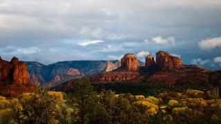
Sedona is open this winter, but it lost its northern road on November 1, 2026, when heavy rain sent Oak Creek over its banks. As of November 3, State Route 89A was closed in both directions through Oak Creek Canyon between Sedona and Kachina Village, with no reopening date. Red Rock State Park was closed until further notice. On November 6 ADOT reopened 89A from Sedona to Slide Rock State Park, which Arizona State Parks said would reopen on November 7; the canyon north of the park stays closed. The town itself and State Route 179 were open, and Visit Sedona said most businesses in the region were unaffected. Winter days here are mild, with average December highs around 58 °F, but most nights drop close to freezing.
Quick facts (checked November 6, 2026)
- SR 89A through Oak Creek Canyon: open from Sedona to Slide Rock State Park since November 6; closed north of the park to the Oak Creek Vista overlook, with no reopening estimate. Drive between Sedona and Flagstaff on SR 179 and Interstate 17.
- SR 179: reopened both ways between Ranger Road and Schnebly Hill Road.
- Closed: Red Rock State Park, until further notice. Slide Rock State Park was due to reopen on November 7. Access to Crescent Moon and Grasshopper Point was "restricted or unconfirmed" on November 3.
- Oak Creek: stay out of the water. Officials reported flood hazards and sewage contamination.
- Red Rock Pass: $5 a day, $15 a week, $20 a year, needed at 19 Forest Service day-use sites.
- Holiday lights: Sedona Tree Lighting at Tlaquepaque on Friday December 4, 2026, 5 to 6:30 p.m., free.
What the Oak Creek flood closed
The November 1 storm brought evacuations, rescues and highway closures across northern Arizona, and around Sedona the worst problems were along Oak Creek, in the neighbourhoods next to the creek and in the canyon. By the afternoon of November 3, most evacuation orders in town had been lifted, though some streets near the creek were still restricted while crews checked them.
The longer-lasting problem is the canyon road. State Route 89A north of town, through Oak Creek Canyon to Kachina Village and Flagstaff, was closed in both directions. On November 6 ADOT reopened it from Sedona to Slide Rock State Park, but north of the park to the Oak Creek Vista overlook it stays closed with no reopening time announced. News reports on November 4 said floodwater had undercut the pavement, and they gave the detour as SR 179 and Interstate 17. If you are coming from Flagstaff or the Grand Canyon, plan on I-17 south and SR 179 north into town. Check az511.gov or dial 511 before every drive, because closure points can move as repairs go on.
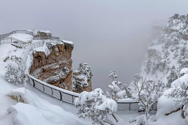
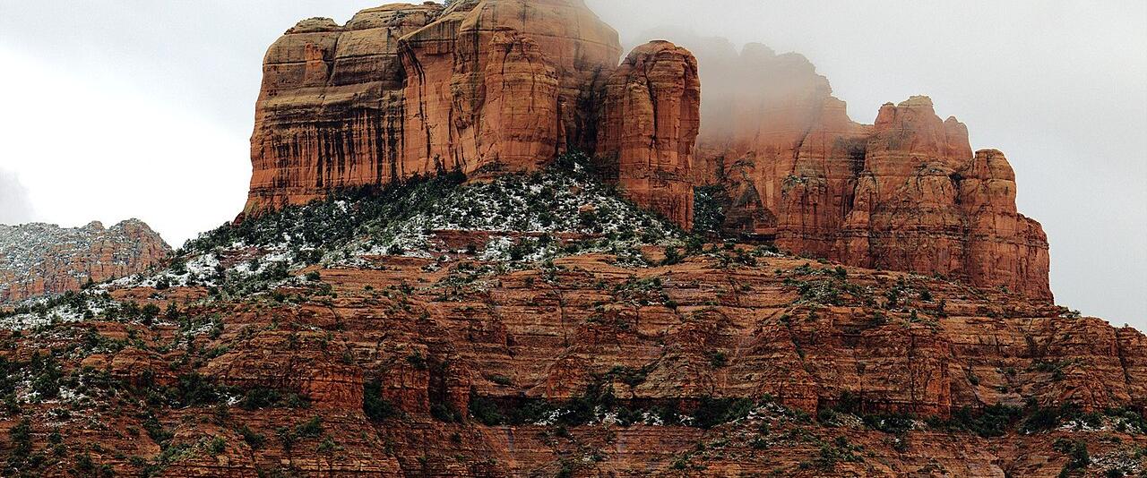
 Snow on the red cliffs of Oak Creek Canyon above Sedona. Image: Janet Ward, NOAA., Public domain, via Wikimedia Commons.
What the flood closed:
- Slide Rock State Park, the old Pendley apple homestead in the canyon. It closed after the flood; Arizona State Parks said it would reopen on November 7, 2026, once ADOT had reopened 89A from Sedona to the park. Its weekend apple-shed open houses and a November 14 creek cleanup were cancelled.
- Red Rock State Park, west of town, which closed because of "flooding of Oak Creek and resulting damage to drives, parking lots, and trails at the park." Its guided walks, bird walks and the November 7 star party were cancelled.
- Creekside sites: Visit Sedona listed access to Crescent Moon (Red Rock Crossing), Grasshopper Point and Slide Rock as "restricted or unconfirmed," and asked everyone to stay out of the creek.
In Cottonwood, Dead Horse Ranch State Park is open, but on November 6 it listed nine trails as closed for hazardous conditions, including the River Loop, Verde River and Tavasci Marsh trails. Owl Road was closed and Flycatcher Road had reopened.
Red Rock Pass
Many of Sedona's red-rock trailheads are Forest Service day-use sites, and parking at them needs a Red Rock Pass or a federal America the Beautiful pass. Visit Sedona's pass page says it is required at 19 day-use sites. They include Cathedral Rock, Baldwin, Bell Rock Pathway, Boynton, Courthouse Butte, Doe Mountain, Dry Creek Trailhead, Fay Canyon, Little Horse, Mescal Trailhead and Yavapai Vista, plus the Palatki Heritage Site and the Crane Petroglyph Heritage Site.
| Pass | Price | Where to buy in person |
|---|---|---|
| Daily | $5 | Kiosks at the sites, Sedona Chamber of Commerce, Red Rock Visitor Center |
| Weekly | $15 | Kiosks, Chamber of Commerce, Red Rock Visitor Center |
| Annual | $20 | Kiosks, Chamber of Commerce (not the Red Rock Visitor Center) |
Display the pass in your windshield, or buy it online through Recreation.gov with your licence plate number. You do not need one for a stop of about 15 minutes or less to take a photo. A separate Coconino Annual Pass ($50) covers the creekside sites at Crescent Moon Ranch, Grasshopper Point and Call of the Canyon/West Fork, but the flood has restricted access to those for now.
Four winter hikes away from the creek
Visit Sedona publishes distances, directions and parking for each of these four, and none of them is among the creekside sites listed as closed or restricted after the flood. Several have small car parks, so start early.
Airport Loop. An easy-to-moderate loop around Airport Mesa, about 3.3 miles round trip from the Airport Road parking area. Add a mile for the short Tabletop Trail. The trail is unshaded, rocky in places and narrow in a few sections. From the visitor centre, turn right on SR 89A for 1 mile and left on Airport Road. The free Airport Saddle parking is 0.5 miles up, with 9 spaces plus one accessible space. The Airport Vista lot higher up charges $3. Look south for Cathedral Rock and north to Thunder Mountain, Chimney Rock and Coffee Pot Rock. Leashed dogs are allowed.
 West Sedona and Thunder Mountain from the Airport Mesa overlook at sunset. Image: Eddiewexler, CC0, via Wikimedia Commons.
Chimney Rock Loop. A moderate 1-mile loop around the base of Chimney Rock, which locals also call Three Fingers. Start at the Thunder Mountain Trailhead: 3.2 miles west on 89A, right on Dry Creek Road for 0.5 miles, then right on Thunder Mountain Road for 0.6 miles. The trailhead has 20 spaces. In 0.1 miles you reach the Chimney Rock junction, and you can look up for Lizard Head on the way round.
 The trail sign for Thunder Mountain and Lower Chimney Rock on the Coconino National Forest. Image: Coconino National Forest, Public domain, via Wikimedia Commons.
Aerie Trail. A moderate out-and-back along the north side of Doe Mountain, with shade in the morning. It runs 2.7 miles each way to the Boynton Canyon Trailhead (5.8 miles round trip). Shorter options are a 3.8-mile out-and-back to the Cockscomb Trail junction or a 4.4-mile loop on the Cockscomb Trail. To get there, take Dry Creek Road 3 miles, Boynton Pass Road 4.1 miles, then Aerie Road. There are 13 spaces plus two accessible, with toilets at the Doe Mountain and Fay Canyon trailheads. Mountain bikers use it too.
 The view northwest towards Bear Mountain from the Doe Mountain Trail. Image: Coconino NF Photography, CC0, via Wikimedia Commons.
Turkey Creek Trail. A quieter, moderate 6-mile round trip that Visit Sedona says is "best November through April" because it is hot and unshaded in summer. It follows an old road for 1.5 miles, then climbs switchbacks on House Mountain, a long-extinct shield volcano, with views back to Cathedral Rock. Take SR 179 south for 7.3 miles, Verde Valley School Road 4.1 miles, then a 0.5-mile unpaved road to a five-car parking area.
 A trail marker on the Aerie Trail below Doe Mountain. Image: davidpinter, CC BY 3.0, via Wikimedia Commons.
Cold mornings and snow days
Sedona sits well below the rim country. NOAA's 1991-2020 normals for the Sedona weather station give average highs of 58 °F in December and January and 61 °F in February. Average lows are 33 °F in December, 34 °F in January and 36 °F in February. The station logs about 56 nights a year at or below freezing, so a 7 a.m. start on Airport Mesa means gloves and layers, even if you are in a T-shirt by noon.
Snow is rare. In NOAA's daily records for the same station, measurable snow fell on no more than five days in any full winter between 1996-97 and 2009-10, and on none at all in most of them. With 89A closed, the drive to Flagstaff and the Grand Canyon is on I-17, so check az511.gov before heading north in a storm.
Day trips in the Verde Valley
With Oak Creek Canyon closed, the Verde Valley to the south and west is the easiest half-day trip from Sedona. Montezuma Castle National Monument, a cliff dwelling near Camp Verde, charges $10 per adult aged 16 and over. The same ticket covers Tuzigoot National Monument near Cottonwood for 7 days, children aged 15 and under are free, and Montezuma Well is free. Palatki and the Crane Petroglyph site need a Red Rock Pass for parking. Check their winter hours before you drive out.
Holiday lights at Tlaquepaque
The first holiday-lights event with a confirmed 2026 date is the Sedona Tree Lighting and Santa Visit on Friday December 4, 2026, from 5 to 6:30 p.m. at Tlaquepaque North, 336 SR 179. Tlaquepaque Arts & Shopping Village runs it together with the Sedona Chamber of Commerce & Tourism Bureau, and entry is free. A 26-foot tree is lit with thousands of lights, Santa arrives, and there are children's activities and free hot chocolate. Tlaquepaque was welcoming visitors back after the flood on November 3, though some of its businesses were still working toward reopening.
 The Patio de las Campañas courtyard at Tlaquepaque in Sedona. Image: Seasider53, CC BY 4.0, via Wikimedia Commons.
Tlaquepaque also holds a luminaria evening, the Festival of Lights, in December. Its 2026 date was not yet listed in early November, so check the village's events calendar before planning around it.
Practical notes
- Getting there: from Phoenix, take I-17 north and SR 179 into Sedona. From Flagstaff, use I-17 south for now, not SR 89A through Oak Creek Canyon.
- Road and closure updates: az511.gov or 511; Arizona State Parks for Slide Rock and Red Rock; the Sedona Visitor Information Center at 331 Forest Road (928-282-7890).
- Passes: a Red Rock Pass or America the Beautiful pass at Forest Service day-use sites. State parks charge their own entry fees.
- The creek: do not wade, swim or let dogs into Oak Creek until officials clear it.
- Mornings: lows near freezing from December to February. Pack layers and a headlamp, since winter days are short.
Road status, closures and prices here are as Visit Sedona, Arizona State Parks, the National Park Service and the event organisers published them between November 3 and 6, 2026. The canyon reopening date is the fact most likely to change.