Arizona's written history covers about five centuries, from Spanish missions and presidios through the Mexican period to a US territory and, in 1912, the 48th state. A lot of it can still be seen on the ground: a presidio ruin, adobe forts, a territorial prison, copper and silver towns, and the old Route 66 through the north.
This guide puts the main periods in order and names the places where each is shown. Dates come from the agencies that run those places, mainly Arizona State Parks and the National Park Service, and from the 1912 statehood proclamation.
Timeline
| Year | Event | Where to see it |
|---|---|---|
| 1752 | Presidio San Ignacio de Tubac founded | Tubac Presidio SHP |
| 1854 | US takes control of southern Arizona after the Gadsden Purchase | — |
| 1863 | Arizona Territory split from New Mexico Territory | Fort Verde SHP |
| 1864 | Territorial capital set up at Prescott | Sharlot Hall Museum |
| 1871–1873 | Camp Verde's permanent post built | Fort Verde SHP |
| 1876 | Yuma Territorial Prison opens | Yuma Territorial Prison SHP |
| 1877 | Ed Schieffelin files the Tombstone and Graveyard claims | Tombstone |
| 1881 | Gunfight at the O.K. Corral (October 26) | O.K. Corral |
| 1882 | Cochise County Courthouse built | Tombstone Courthouse SHP |
| February 14, 1912 | Arizona admitted as the 48th state | — |
| 1926 | Route 66 established | Arizona Route 66 Museum |
| 1953 | Mining ends at Jerome | Jerome SHP |
Spanish and Mexican Arizona
Arizona State Parks says Tubac Presidio protects the ruins of the oldest Spanish presidio site in Arizona, San Ignacio de Tubac, founded in 1752. Its cavalrymen protected settlers and explored the region. The presidio's second commander, Juan Bautista de Anza, led the expedition that founded San Francisco in 1776. Sixty-three of its 240 colonists came from Tubac. Another Spanish presidio, Santa Cruz de Terrenate, stood on the San Pedro River. The Bureau of Land Management looks after its ruins inside the San Pedro Riparian National Conservation Area.
Missions came with the soldiers. NPS describes Tumacácori, in the Santa Cruz River valley, as a place where O'odham, Yaqui and Apache people met Jesuit and Franciscan missionaries, settlers and soldiers, "sometimes in conflict and sometimes in cooperation."
The land passed from New Spain to Mexico and then to the United States after the 1854 Gadsden Purchase. The Heard Museum notes that the Akimel O'otham have held through all these changes that the land is theirs.
The territory, 1863–1912
Arizona State Parks dates the Arizona Territory to 1863, when the New Mexico Territory was divided, and the territorial capital to Prescott in 1864. Sharlot Hall, Arizona's Territorial Historian and the first woman to hold a salaried office in Arizona, began restoring the first territorial governor's residence in 1927. The "Gubernatorial Mansion Museum" opened in 1928, and after her death in 1943 it was renamed the Sharlot Hall Museum.
Yuma Territorial Prison. The territorial legislature authorised it in 1875. Ground was broken on April 28, 1876, and the first seven inmates arrived on July 1. It ran for 33 years, until overcrowding moved the inmates to Florence.
Frontier forts
Fort Verde, Camp Verde. Anglo settlers at West Clear Creek came into conflict with the Tonto Apache and Yavapai people already living there, and in 1865 they asked for military protection. The first volunteer units were almost all Mexican recruits. Malaria drove the army to move the post, and the permanent fort was built between 1871 and 1873: 22 buildings around a parade ground. In 1875 Congress ordered the people of the Rio Verde Reservation moved to San Carlos. On the 180-mile winter march, about 100 people died or disappeared. Troop I of the 10th Cavalry, a Buffalo Soldier unit, arrived at Fort Verde in 1885. The fort was abandoned in April 1891.
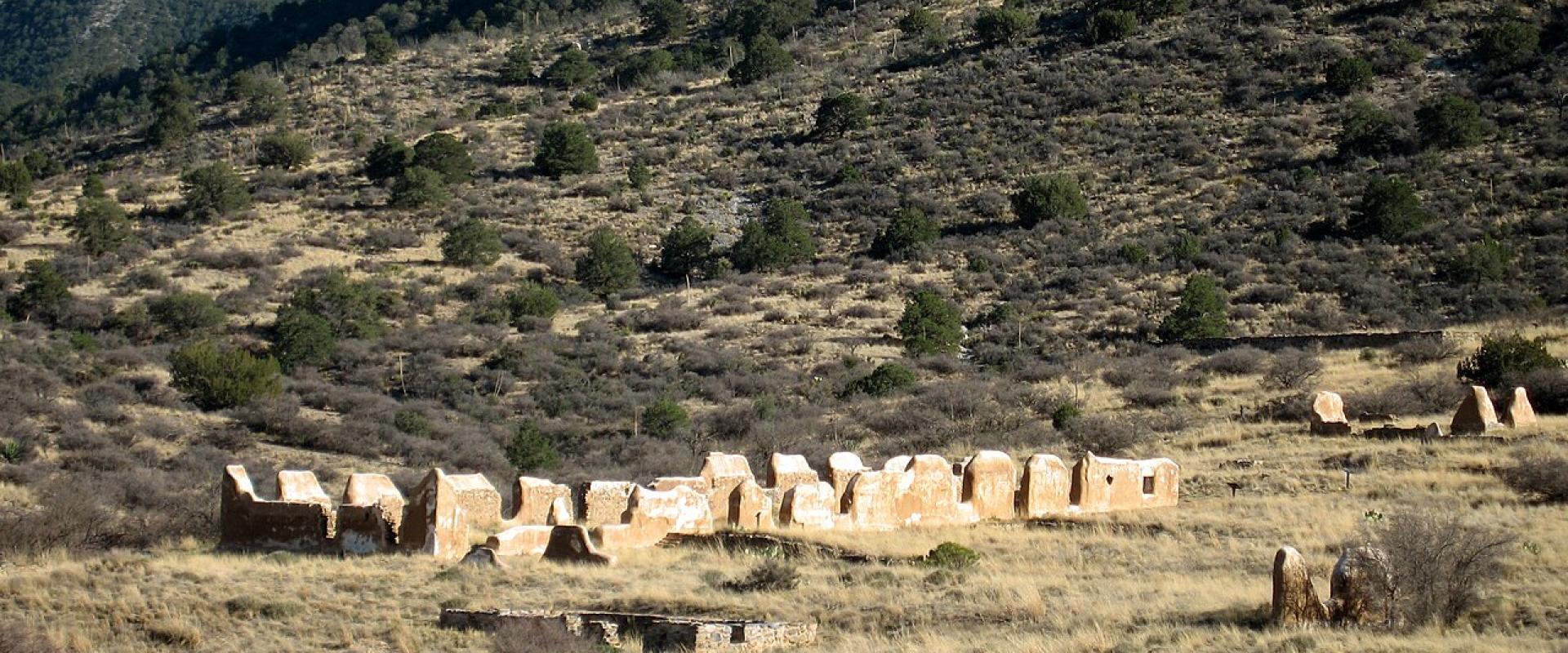
Fort Bowie National Historic Site. NPS says that for nearly 25 years Fort Bowie stood at the crossroads of the Chiricahua Apache fight to defend their homeland and the US Army's westward expansion. Little of the fort remains. You reach the ruins and visitor centre on a three-mile loop hike, and the grounds are open sunrise to sunset every day.
Mining towns
Tombstone (silver). In 1877 the prospector Ed Schieffelin was using Fort Huachuca as a base. A soldier told him he would find only his tombstone. In August he filed the Tombstone and Graveyard claims, then developed them with his brother Albert and Richard Gird. In 1880 he sold his share for $500,000. Cochise County was created in 1881 with Tombstone as its seat, and the red-brick courthouse followed in 1882. The seat moved to Bisbee in 1931. Schieffelin is buried just northwest of town, and his monument is now part of the courthouse state park.
Jerome (copper). Three prospectors staked copper claims in 1876. The camp was named after Eugene Jerome, a backer of the United Verde Copper Company. It struggled until William A. Clark brought in a narrow-gauge railroad, and by the early 1900s the United Verde was the largest producing copper mine in the territory. James S. "Rawhide" Douglas began developing the Little Daisy mine in 1912. Copper output peaked in 1929. The Little Daisy closed in 1938, and Jerome's mining ended in 1953.
Bisbee (copper). The Bisbee Mining & Historical Museum, a Smithsonian Affiliate, tells how a western copper town contributed to America's industrialisation.
Statehood
Congress authorised Arizona to write a constitution on June 20, 1910. A joint resolution of August 21, 1911 then made admission conditional: voters first had to adopt an amendment to Section 1 of Article 8 of their constitution. They did so at the first state election on December 12, 1911. President Taft signed the proclamation admitting Arizona on February 14, 1912, making it the 48th state.
Route 66
Route 66 was established in 1926. Explore Kingman, the city's visitor site, describes the town as sitting on the longest remaining continuous stretch of the highway. Kingman has called itself the "Heart of Historic Route 66" since 1993 and is marking the highway's centennial in 2026. In 2023 the town installed an exhibit honouring Angel Delgadillo, the Seligman barber whose campaign in the 1980s helped revive the highway. The Arizona Route 66 Museum in Kingman covers the road's history. A ticket costs $10 for ages 13 to 59 and $6 for seniors 60 and over, and it also admits you to the Mohave Museum of History and Arts.
Planning a history route
- South: Tubac Presidio and Tumacácori are both in the Santa Cruz River valley. Tombstone, Bisbee and Fort Bowie are all in Cochise County.
- Central: Prescott has the Sharlot Hall Museum. Fort Verde and Jerome are in the Verde Valley.
- West and north: Yuma Territorial Prison stands above the Colorado River. Route 66 crosses the north through Kingman.
- Hours: Fort Bowie's visitor centre hours vary. Tubac Presidio is closed on Mondays. Call ahead.
Most Arizona State Parks historic parks charge adults (14+) $10 in 2026.
Details checked November 6, 2026.